Tag / mapping
-
![]()
Find My iPhone/iPad
Plugged my iPhone into sync and got a message to signup for free “find my iPhone” feature in MobileMe. The find feature for iPhone/iPad/iPod Touch lets users find the missing device remotely…
-
![]()
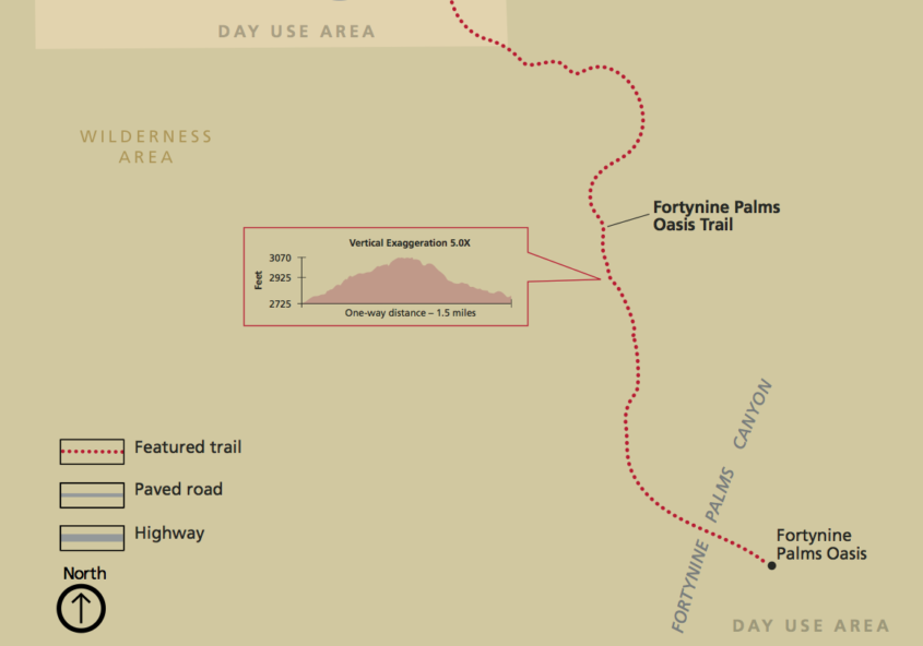
Urban Forest Map
I was still curious after taking this photo of the trees on 24th Street at Bryant earlier today. How could I identify these trees? I did several searches on variations of “trees…
-
![]()
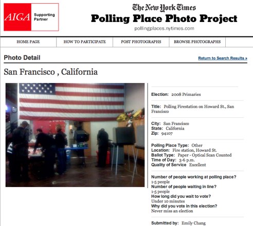
Super Tuesday Online
I always get excited when it’s an election year, but particularly this one because it’s been eight long years. Two web projects related to the U.S. election caught my attention today. First,…
-
![]()
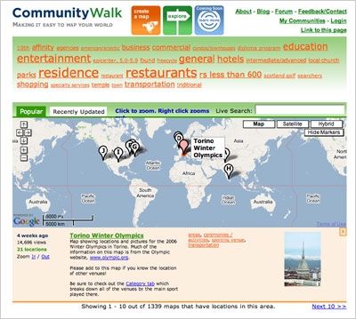
Explore CommunityWalk
CommunityWalk, the web 2.0 mapping community, has launched the new Explore feature. The Explore page lets you zoom into the map, select a category, or use a live search to find different…
-
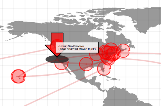
Google Visitor Map Zooms
There have been some excellent examples of Google map applications recently like Plazes, which allows you to discover locations and find people by proximity or location, and Mappr, where you can view…
-
Virtual plazes become real
The web has always attracted me because of the play between what’s real, virtual, and how one can become the other fairly easily. While others have framed this much more eloquently than…
-
Web Mapping Technology
I was searching to see if anyone had released some Ajax-driven maps and came across “Build AJAX-Based Web Maps Using ka-Map” by Tyler Mitchell which led me to an open source map…
-
![]()
XML and Flash Map of My Travels
I found Bryan Boyer’s IndyJunior several years ago when it was still v1.3 and played with it back then. For some reason, it popped into my head again the other day so…
-
Around the world
My travels so far… World travel by country (18 countries, 8% of the world) By U.S. state (26 states, 50%) By Canadian province (3 provinces, 23%) By European country (2 countries, 3%)…